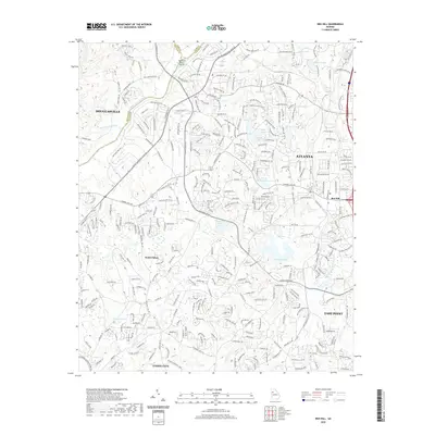
2020 Map of Ben Hill
USGS Topo · Published 2020About this map
The Chattahoochee River carves a major physical boundary through this 2020 landscape, separating Douglas and Fulton counties near Buzzard Roost Island. This area of Southwest Atlanta is defined by a complex network of residential expansion and preserved water resources. Named settlements like Ben Hill and South Fulton anchor the urban fabric, while the City of East Point Reservoir and Copart Lake sit within the drainage of Camp Cr.
Find a feature on this map
309 named features on this map. Tap any name to fly to it.
Don’t see what you’re looking for? This feature index may not catch every label — zoom into the map to look around manually.
Map Details
Editions of this 2020 Ben Hill Map
This is the sole edition of this map. No revisions or reprints were ever made.
Other maps of this area

1888 · Atlanta
USGS Topo · 1:125,000

1890 · Atlanta
USGS Topo · 1:125,000

1891 · Marietta
USGS Topo · 1:125,000

1892 · Atlanta
USGS Topo · 1:125,000

1895 · Atlanta
USGS Topo · 1:125,000

1895 · Marietta
USGS Topo · 1:125,000

1897 · Marietta
USGS Topo · 1:125,000

1901 · Marietta
USGS Topo · 1:125,000

1953 · Atlanta
USGS Topo · 1:250,000

1954 · Palmetto
USGS Topo · 1:24,000