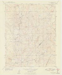
1948 Map of Ben Hur
USGS Topo · Published 1948About this map
Ben Hur serves as the focal point of this rural California landscape, situated amidst a network of cattle-grazing hills and seasonal drainages. The 1940s environment is defined by its educational and navigational landmarks, including Ben Hur Sch, Oakgrove Sch, and Oakvale Sch, which suggest a distributed community of ranching families. The southern portion of the quadrangle is anchored by Green Mtn Lookout and the Green Mtn Sch near the Chowchilla River. Modern transit is limited to the Raymond Road, while the natural terrain is marked by prominent granite outcrops like Bald Rock and Split Rock. A small Cem located near the main settlement provides a specific point of interest for genealogical research in this sparsely populated region of the Sierra foothills.
Find a feature on this map
26 named features on this map. Tap any name to fly to it.
Don’t see what you’re looking for? This feature index may not catch every label — zoom into the map to look around manually.
Map Details
Editions of this 1948 Ben Hur Map
2 editions found
Other maps of this area

1912 · Mariposa
USGS Topo · 1:125,000

1919 · Indian Gulch
USGS Topo · 1:48,000

1919 · Raynor Creek
USGS Topo · 1:31,680

1920 · Indian Gulch
USGS Topo · 1:62,500

1942 · Raymond
USGS Topo · 1:62,500

1944 · Raymond
USGS Topo · 1:62,500
1946 · Le Grand
USGS Topo · 1:62,500
1947 · Raynor Creek
USGS Topo · 1:24,000

1947 · Mariposa
USGS Topo · 1:24,000

1947 · San Jose
USGS Topo · 1:250,000