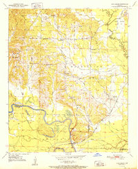
1951 Map of Ben Lomond
USGS Topo · Published 1951About this map
Ben Lomond serves as the focal point for this early 1950s survey of the Sevier and Little River county border. The landscape is defined by the winding course of the Little River and a complex network of sloughs and lakes, including Grassy Lake, Trout Lake, and McGuire Lake. The influence of the lumber and transport era is evident in the path of the Graysonia Nashville and Ashdown railroad, which links smaller communities like White Cliffs and Paraloma to the larger region.
Find a feature on this map
47 named features on this map. Tap any name to fly to it.
Don’t see what you’re looking for? This feature index may not catch every label — zoom into the map to look around manually.
Map Details
Editions of this 1951 Ben Lomond Map
2 editions found
Other maps of this area

1950 · Ashdown East
USGS Topo · 1:24,000

1950 · Ashdown West
USGS Topo · 1:24,000

1950 · Red Bluff
USGS Topo · 1:24,000

1950 · Ben Lomond
USGS Topo · 1:24,000

1950 · Falls Chapel
USGS Topo · 1:24,000

1951 · Ben Lomond
USGS Topo · 1:24,000

1951 · Ashdown West
USGS Topo · 1:24,000

1951 · Red Bluff
USGS Topo · 1:24,000

1951 · Falls Chapel
USGS Topo · 1:24,000

1951 · Ashdown East
USGS Topo · 1:24,000