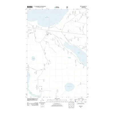
2011 Map of Bena
USGS Topo · Published 2011About this map
Lake Winnibigoshish and Leech Lake dominate the northern and southwestern corners of this survey, framing a landscape defined by water and forest management. The small settlement of Bena serves as the primary hub, situated near the Bena Post Office and along the corridor of Resvn Hwy 20. The infrastructure of the Chippewa National Forest is evident through several Forest Service routes and the Boulder Hill Lookout Tower, which provides a vantage point over the surrounding lake system.
Find a feature on this map
18 named features on this map. Tap any name to fly to it.
Don’t see what you’re looking for? This feature index may not catch every label — zoom into the map to look around manually.
Map Details
Editions of this 2011 Bena Map
This is the sole edition of this map. No revisions or reprints were ever made.
Other maps of this area

1954 · Bemidji
USGS Topo · 1:250,000

1957 · Bemidji
USGS Topo · 1:250,000

1958 · Bemidji
USGS Topo · 1:250,000

1971 · Nushka Lake
USGS Topo · 1:24,000

1971 · Raven Lake
USGS Topo · 1:24,000

1971 · Bena
USGS Topo · 1:24,000
1971 · Bena NW
USGS Topo · 1:24,000
1971 · Federal Dam
USGS Topo · 1:24,000

1971 · Portage Lake
USGS Topo · 1:24,000
1971 · Boy River
USGS Topo · 1:24,000