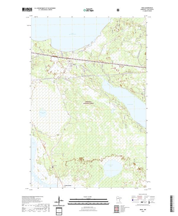
2022 Map of Bena
USGS Topo · Published 2022About this map
Lake Winnibigoshish and the vast Leech Lake dominate the northern and southwestern corners of this landscape within the Chippewa National Forest. The settlement of Bena serves as a central hub, situated along the railroad corridor and highway system that bisects the region. The landscape is defined by an intricate network of water and wetlands, with smaller bodies like Hole-in-Bog Lake, Sixmile Lake, and Drumbeater Lake connected by drainages such as Sixmile Brook and the Leech Lake River. Local history is anchored by Fairview Cem and the proximity to Federal Dam at the southern edge. Modern recreational use is evident through an extensive trail network, including the Soo Line Atv Trl, Winnie Snowmobile Trl, and N Star Trl Ne, which follow old corridors through the timberland.
Find a feature on this map
30 named features on this map. Tap any name to fly to it.
Don’t see what you’re looking for? This feature index may not catch every label — zoom into the map to look around manually.
Map Details
Editions of this 2022 Bena Map
This is the sole edition of this map. No revisions or reprints were ever made.
Other maps of this area

1954 · Bemidji
USGS Topo · 1:250,000

1957 · Bemidji
USGS Topo · 1:250,000

1958 · Bemidji
USGS Topo · 1:250,000

1971 · Nushka Lake
USGS Topo · 1:24,000

1971 · Raven Lake
USGS Topo · 1:24,000

1971 · Bena
USGS Topo · 1:24,000
1971 · Bena NW
USGS Topo · 1:24,000
1971 · Federal Dam
USGS Topo · 1:24,000

1971 · Portage Lake
USGS Topo · 1:24,000
1971 · Boy River
USGS Topo · 1:24,000