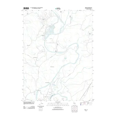
2012 Map of Bend
USGS Topo · Published 2012About this map
The Sacramento River carves a deep, winding path through this portion of Tehama County, defining a landscape of riparian corridors and prominent topographic overlooks. The settlement of Bend serves as a focal point near the southern edge of the map, connected by the Bend Bridge to the western shore. Further north, the legacy of large-scale landholding is evident in the numerous named estates including Ekelund Ranch, Battle Creek Ranch, and the Rancho Rio Alto.
Find a feature on this map
47 named features on this map. Tap any name to fly to it.
Don’t see what you’re looking for? This feature index may not catch every label — zoom into the map to look around manually.
Map Details
Editions of this 2012 Bend Map
This is the sole edition of this map. No revisions or reprints were ever made.
Other maps of this area

1890 · Red Bluff
USGS Topo · 1:250,000

1894 · Red Bluff
USGS Topo · 1:250,000

1905 · Tehama
USGS Topo · 1:62,500

1944 · Tuscan Buttes
USGS Topo · 1:62,500

1947 · Tuscan Buttes
USGS Topo · 1:62,500

1947 · Anderson
USGS Topo · 1:62,500

1948 · Anderson
USGS Topo · 1:62,500

1951 · Red Bluff East
USGS Topo · 1:24,000

1951 · Red Bluff West
USGS Topo · 1:24,000
1951 · Tuscan Springs
USGS Topo · 1:24,000