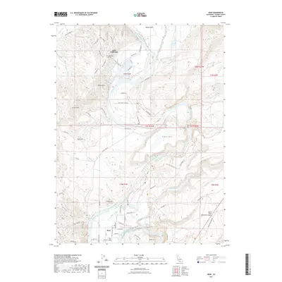
2021 Map of Bend
USGS Topo · Published 2021About this map
The Sacramento River carves a deep, winding path through this portion of Tehama County, creating distinct geographic landmarks such as Iron Canyon and the Chinese Rapids. To the north, the planned community of Lake California is centered around a complex network of residential streets like Rio Alto Dr and Big Bend Dr, supported by the Lake California Air Park. This modern development contrasts with the more rural southern reaches near the settlements of Bend and Big Bend. The terrain is characterized by prominent elevations including Table Mtn and Lookout Mtn, while the river's historic significance is noted by landmarks like Bloody Island. A series of recreational routes, including the Oak Slough Trl and various branches of the Yana Trl, weave through the hillsides, following the natural contours of the river valley and its tributaries like Paynes Creek.
Find a feature on this map
79 named features on this map. Tap any name to fly to it.
Don’t see what you’re looking for? This feature index may not catch every label — zoom into the map to look around manually.
Map Details
Editions of this 2021 Bend Map
This is the sole edition of this map. No revisions or reprints were ever made.
Other maps of this area

1890 · Red Bluff
USGS Topo · 1:250,000

1894 · Red Bluff
USGS Topo · 1:250,000

1905 · Tehama
USGS Topo · 1:62,500

1944 · Tuscan Buttes
USGS Topo · 1:62,500

1947 · Tuscan Buttes
USGS Topo · 1:62,500

1947 · Anderson
USGS Topo · 1:62,500

1948 · Anderson
USGS Topo · 1:62,500

1951 · Red Bluff East
USGS Topo · 1:24,000

1951 · Red Bluff West
USGS Topo · 1:24,000
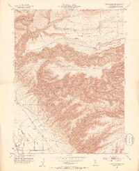
1951 · Tuscan Springs
USGS Topo · 1:24,000