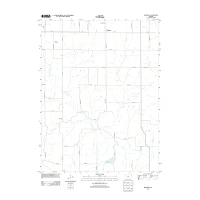
2012 Map of Bendena
USGS Topo · Published 2012About this map
Bendena anchors the northern portion of this Doniphan County landscape, characterized by a structured grid of rural roads and the winding course of Cold Ryan Br. The map is particularly significant for genealogists, as it documents several small burial sites scattered across the township. These include the Bitner Cem in the northwest, the Vickery Family Cem further east, and the Robertson Cem located in the central portion of the quadrangle. The terrain is defined by the drainage patterns of local creeks, illustrating the enduring agricultural layout of Northeast Kansas in the early twenty-first century.
Find a feature on this map
5 named features on this map. Tap any name to fly to it.
Don’t see what you’re looking for? This feature index may not catch every label — zoom into the map to look around manually.
Map Details
Editions of this 2012 Bendena Map
This is the sole edition of this map. No revisions or reprints were ever made.
Other maps of this area

1885 · Atchison
USGS Topo · 1:125,000

1888 · Atchison
USGS Topo · 1:125,000

1893 · Atchison
USGS Topo · 1:125,000

1926 · Atchison
USGS Topo · 1:62,500

1926 · Oregon
USGS Topo · 1:62,500

1950 · Kansas City
USGS Topo · 1:250,000
1951 · Rushville
USGS Topo · 1:24,000

1954 · Kansas City
USGS Topo · 1:250,000

1956 · Kansas City
USGS Topo · 1:250,000
1959 · Sparks
USGS Topo · 1:24,000