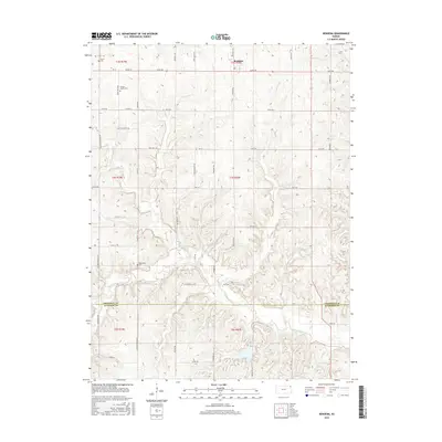
2015 Map of Bendena
USGS Topo · Published 2015About this map
Bendena anchors the northern portion of this survey, situated at the intersection of Friendship Rd and 160th Rd. The landscape is defined by the winding paths of Independence Cr and Jordan Cr, which carve through the terrain as they flow toward the county line. For those tracing local families, several small burial sites are documented across the rural townships, including the Vickery Family Cem near Dove Creek Rd and the Robertson Cem further south. The survey captures the intricate network of section-line roads, such as Diamond Springs Rd and Kennekuk Rd, that connect isolated farmsteads across the Doniphan Co Atchison Co border. This layout reflects the enduring grid-based agricultural settlement patterns that have shaped the region since the late nineteenth century.
Find a feature on this map
49 named features on this map. Tap any name to fly to it.
Don’t see what you’re looking for? This feature index may not catch every label — zoom into the map to look around manually.
Map Details
Editions of this 2015 Bendena Map
This is the sole edition of this map. No revisions or reprints were ever made.
Other maps of this area

1885 · Atchison
USGS Topo · 1:125,000

1888 · Atchison
USGS Topo · 1:125,000

1893 · Atchison
USGS Topo · 1:125,000

1926 · Atchison
USGS Topo · 1:62,500

1926 · Oregon
USGS Topo · 1:62,500

1950 · Kansas City
USGS Topo · 1:250,000
1951 · Rushville
USGS Topo · 1:24,000

1954 · Kansas City
USGS Topo · 1:250,000

1956 · Kansas City
USGS Topo · 1:250,000
1959 · Sparks
USGS Topo · 1:24,000