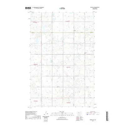
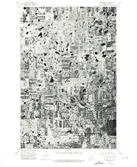
2020 Map of Benedict SW
USGS Topo · Published 2020About this map
Glacial potholes and small wetlands dominate this section of the Missouri Plateau along the border of Ward and McLean counties. The landscape is defined by its agrarian grid, where section lines double as local transit corridors like 373rd Ave SE and 28th St NW. These roads connect isolated religious and community landmarks that speak to the area's ethnic and denominational history. Notable sites include the Church of God Cem in the northern reaches and the Second Russian Baptist Cem further east, reflecting the diverse pioneer heritage of the North Dakota prairie. In the southern portion of the quadrangle, the Saint Mathew Cem sits near the intersection of 25th St NW, while the route of Old Hwy 83 cuts through the southwestern corner, tracing an earlier era of regional travel before modern highway realignments.
Find a feature on this map
25 named features on this map. Tap any name to fly to it.
Don’t see what you’re looking for? This feature index may not catch every label — zoom into the map to look around manually.
Map Details
Editions of this 2020 Benedict SW Map
This is the sole edition of this map. No revisions or reprints were ever made.
Other maps of this area

1922 · Garrison
USGS Topo · 1:62,500

1929 · Coleharbor
USGS Topo · 1:62,500

1929 · Benedict
USGS Topo · 1:62,500

1954 · McClusky
USGS Topo · 1:250,000

1958 · McClusky
USGS Topo · 1:250,000

1974 · Benedict SE
USGS Topo · 1:24,000
1974 · Benedict NW
USGS Topo · 1:24,000
1974 · Benedict NE
USGS Topo · 1:24,000
1974 · Coleharbor NE
USGS Topo · 1:24,000
1974 · Benedict SW
USGS Topo · 1:24,000