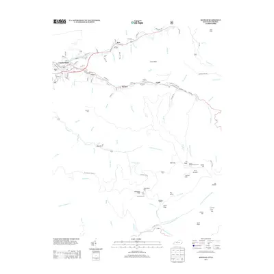
2013 Map of Benham
USGS Topo · Published 2013About this map
The Poor Fork Cumberland River and Clover Fork Cumberland River carve through the high ridges of Harlan County, defining the industrial and social landscape of this coal-country region. In the early 21st century, the tight-knit mountain corridor connects the historic mining communities of Cumberland, Benham, and Lynch along the banks of Looney Cr. The map captures the dense street grids of these company towns, featuring names like Kentucky Ave and Church St, which contrast with the surrounding steep terrain of Black Mountain and Looney Ridge.
Find a feature on this map
121 named features on this map. Tap any name to fly to it.
Don’t see what you’re looking for? This feature index may not catch every label — zoom into the map to look around manually.
Map Details
Editions of this 2013 Benham Map
This is the sole edition of this map. No revisions or reprints were ever made.
Other maps of this area

1887 · Jonesville
USGS Topo · 1:125,000

1890 · Whitesburg
USGS Topo · 1:125,000

1891 · Hazard
USGS Topo · 1:125,000

1891 · Jonesville
USGS Topo · 1:125,000

1892 · Whitesburg
USGS Topo · 1:125,000

1894 · Estillville
USGS Topo · 1:125,000

1913 · Oven Fork
USGS Topo · 1:48,000

1915 · Whitesburg
USGS Topo · 1:62,500

1916 · Cornettsville
USGS Topo · 1:62,500

1916 · Nolansburg
USGS Topo · 1:48,000