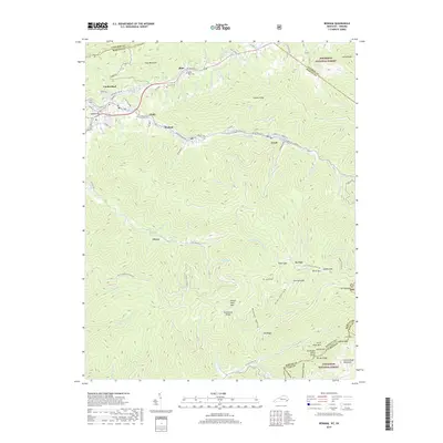
2019 Map of Benham
USGS Topo · Published 2019About this map
Cumberland and Lynch anchor this detailed study of the steep Appalachian landscape along the Kentucky Virginia border. The map documents the tight urban footprints of these coal-country settlements, where development follows the narrow floor of the Poor Fork Cumberland River valley. To the north, the massive wall of Pine Mountain defines the topography, while to the south, Black Mtn and Little Black Mtn rise towards the Tennessee Valley Divide. Genealogists will find family-named landmarks including the Israel Blair Cem, Creech Cem, and Adams Cem, alongside small communities like Blair, Benham, and Clover. The map illustrates a complex network of mountain drainages, from Looney Cr in the north to the Clover Fork Cumberland River and its numerous branches like Razor Fork and Clark Fork in the south, much of which is protected within the Jefferson National Forest.
Find a feature on this map
104 named features on this map. Tap any name to fly to it.
Don’t see what you’re looking for? This feature index may not catch every label — zoom into the map to look around manually.
Map Details
Editions of this 2019 Benham Map
This is the sole edition of this map. No revisions or reprints were ever made.
Other maps of this area

1887 · Jonesville
USGS Topo · 1:125,000

1890 · Whitesburg
USGS Topo · 1:125,000

1891 · Hazard
USGS Topo · 1:125,000

1891 · Jonesville
USGS Topo · 1:125,000

1892 · Whitesburg
USGS Topo · 1:125,000

1894 · Estillville
USGS Topo · 1:125,000

1913 · Oven Fork
USGS Topo · 1:48,000

1915 · Whitesburg
USGS Topo · 1:62,500

1916 · Cornettsville
USGS Topo · 1:62,500

1916 · Nolansburg
USGS Topo · 1:48,000