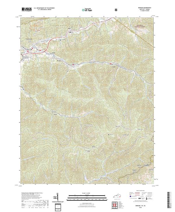
2022 Map of Benham
USGS Topo · Published 2022About this map
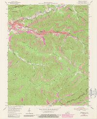
The Poor Fork Cumberland River carves a narrow valley between Pine Mountain and the towering ridge of Black Mtn, defining a landscape of concentrated mountain settlements and steep drainages. In this pocket of Harlan County, the company towns of Lynch and Benham stretch along Looney Cr, their layouts following the contours of the valley floor. The map shows the institutional presence of the Southeast Kentucky Community and Technical College in Cumberland, while higher elevations remain largely undeveloped within the Jefferson National Forest. Small family cemeteries like Blair Cem and Creech Cem are tucked into the lower slopes near Blair, providing vital coordinates for genealogists. The topography is further marked by the Tennessee Valley Divide along the southern border, where the waters split between the Clover Fork Cumberland River and the local forks of Looney Cr.
Find a feature on this map
121 named features on this map. Tap any name to fly to it.
Don’t see what you’re looking for? This feature index may not catch every label — zoom into the map to look around manually.
Map Details
Editions of this 2022 Benham Map
This is the sole edition of this map. No revisions or reprints were ever made.
Historical Maps of Cumberland Through Time
8 maps found