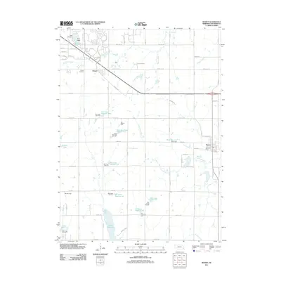
2011 Map of Bennet
USGS Topo · Published 2011About this map
Bennet and the smaller settlement of Cheney anchor this Lancaster County landscape, which is defined by a dense network of water management projects and rural road corridors. The southeastern corner of the Lincoln area shows a transition from suburban expansion near Pine Lake Reservoir to the open agricultural fields surrounding the Little Nemaha River. Local history is preserved at the Cheney Cemetery and within the established streets of Bennet, where the Bennet Post Office serves the local community.
Find a feature on this map
56 named features on this map. Tap any name to fly to it.
Don’t see what you’re looking for? This feature index may not catch every label — zoom into the map to look around manually.
Map Details
Editions of this 2011 Bennet Map
This is the sole edition of this map. No revisions or reprints were ever made.
Other maps of this area

1897 · Lincoln
USGS Topo · 1:125,000

1903 · Weeping Water
USGS Topo · 1:125,000

1929 · Weeping Water
USGS Topo · 1:125,000

1955 · Lincoln
USGS Topo · 1:250,000

1957 · Lincoln
USGS Topo · 1:250,000

1958 · Lincoln
USGS Topo · 1:250,000

1964 · Cortland
USGS Topo · 1:24,000

1964 · Roca
USGS Topo · 1:24,000

1964 · Walton
USGS Topo · 1:24,000
1964 · Lincoln
USGS Topo · 1:24,000