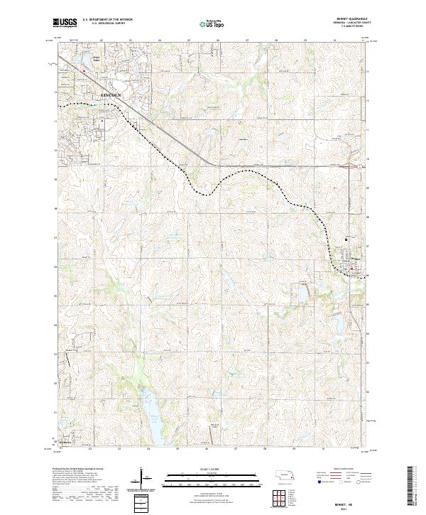
2021 Map of Bennet
USGS Topo · Published 2021About this map
Wagon Train Lake and a series of flood-control impoundments dominate this landscape southeast of Lincoln. The terrain reflects the transition from the city's suburban fringe to the agricultural plains of Lancaster County, where the Little Nemaha River and its tributaries, such as Hickman Br, carve through the rolling farmland. The settlement of Bennet sits as a central hub, flanked by the Bennet Cem to its north, while Hickman appears at the southern edge of the sheet. Local landmarks like Mueller Field and Walvoord Field illustrate the rural aviation history of the region. This 2021 survey also details a dense network of reservoirs including Salt Cr Reservoir 19-B and Kuhn Reservoir, highlighting the modern management of the Salt Creek watershed and its impact on the local geography.
Find a feature on this map
105 named features on this map. Tap any name to fly to it.
Don’t see what you’re looking for? This feature index may not catch every label — zoom into the map to look around manually.
Map Details
Editions of this 2021 Bennet Map
This is the sole edition of this map. No revisions or reprints were ever made.
Other maps of this area

1897 · Lincoln
USGS Topo · 1:125,000

1903 · Weeping Water
USGS Topo · 1:125,000

1929 · Weeping Water
USGS Topo · 1:125,000

1955 · Lincoln
USGS Topo · 1:250,000

1957 · Lincoln
USGS Topo · 1:250,000

1958 · Lincoln
USGS Topo · 1:250,000

1964 · Cortland
USGS Topo · 1:24,000

1964 · Roca
USGS Topo · 1:24,000

1964 · Walton
USGS Topo · 1:24,000
1964 · Lincoln
USGS Topo · 1:24,000