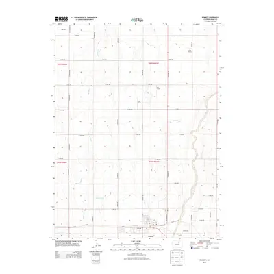
2013 Map of Bennett
USGS Topo · Published 2013About this map
Bennett serves as a local hub near the southern edge of this map, situated where Us-36 and the historic Old Victory Rd converge. The landscape is defined by the winding course of Kiowa Creek to the east and the drainages of W Sand Cr, which together shape the terrain of this high plains region. This area demonstrates a high concentration of private aviation infrastructure, featuring several small facilities including Logan Airport, Hoy Airstrip, J & S Airport, and Yoder Airstrip scattered across the township grid. For those researching local heritage, the Bennett Cem is located just north of the town center. The map also captures the agricultural water management of the district, evidenced by the Layne Reservoir, which sits amidst a network of section roads like N Penrith Rd and Converse Rd.
Find a feature on this map
41 named features on this map. Tap any name to fly to it.
Don’t see what you’re looking for? This feature index may not catch every label — zoom into the map to look around manually.
Map Details
Editions of this 2013 Bennett Map
This is the sole edition of this map. No revisions or reprints were ever made.
Other maps of this area

1890 · East Denver
USGS Topo · 1:125,000

1949 · Sunnydale
USGS Topo · 1:24,000

1949 · Bennett
USGS Topo · 1:24,000

1950 · Roper School
USGS Topo · 1:24,000

1951 · Roper School
USGS Topo · 1:24,000

1951 · Living Springs
USGS Topo · 1:24,000

1951 · Manila
USGS Topo · 1:24,000
1952 · Horse Creek
USGS Topo · 1:24,000

1953 · Denver
USGS Topo · 1:250,000

1954 · Watkins
USGS Topo · 1:24,000