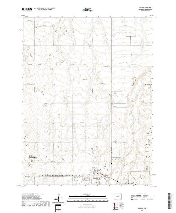
2022 Map of Bennett
USGS Topo · Published 2022About this map
Bennett serves as a primary hub for this Eastern Plains landscape, where the intersection of E Colfax Ave and several local streets such as Palmer Ave and Kiowa Ave anchors the community. To the west, the encroaching reach of Aurora marks the transition from suburban expansion to open agricultural sections. The map reveals a high density of private aviation infrastructure, including Logan Airport, Hoy Airstrip, J & S Airport, and Yoder Airstrip, reflecting the importance of aerial access in this rural region. The terrain is defined by the ephemeral drainages of W Sand Cr and the more prominent Kiowa Creek to the east. Local history and genealogy interest is centered on the Mount View Cem, located north of the town center near Kiowa Bennett Rd.
Find a feature on this map
48 named features on this map. Tap any name to fly to it.
Don’t see what you’re looking for? This feature index may not catch every label — zoom into the map to look around manually.
Map Details
Editions of this 2022 Bennett Map
This is the sole edition of this map. No revisions or reprints were ever made.
Other maps of this area

1890 · East Denver
USGS Topo · 1:125,000

1949 · Sunnydale
USGS Topo · 1:24,000

1949 · Bennett
USGS Topo · 1:24,000

1950 · Roper School
USGS Topo · 1:24,000

1951 · Roper School
USGS Topo · 1:24,000

1951 · Living Springs
USGS Topo · 1:24,000

1951 · Manila
USGS Topo · 1:24,000
1952 · Horse Creek
USGS Topo · 1:24,000

1953 · Denver
USGS Topo · 1:250,000

1954 · Watkins
USGS Topo · 1:24,000