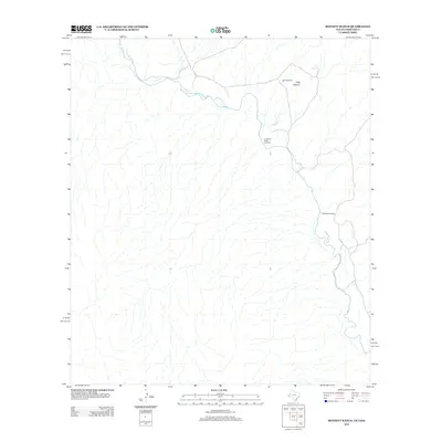
2012 Map of Bennett Ranch
USGS Topo · Published 2012About this map
Rio Grande drainage and international borderlands define this arid landscape along the Texas-Mexico line in the early 21st century. The map centers on the Bennett Ranch and the surrounding canyon country, where seasonal watercourses like Sand Cr and the waters of Ash Spring are critical landmarks. Historically significant transit points along the river are clearly identified, including the Lomas de Arena Crossing and Donahue Crossing, reflecting traditional routes across the river where terrain and hydrology allow. This portion of the border is characterized by the deep incision of Hog Canyon, illustrating the complex topography that has shaped settlement and movement in this part of Chihuahua and West Texas.
Find a feature on this map
7 named features on this map. Tap any name to fly to it.
Don’t see what you’re looking for? This feature index may not catch every label — zoom into the map to look around manually.
Map Details
Editions of this 2012 Bennett Ranch Map
This is the sole edition of this map. No revisions or reprints were ever made.
Other maps of this area

1892 · Chispa
USGS Topo · 1:125,000

1895 · Chispa
USGS Topo · 1:125,000

1896 · San Carlos
USGS Topo · 1:125,000

1897 · Eagle Mountain
USGS Topo · 1:125,000

1897 · Chispa
USGS Topo · 1:125,000

1916 · Eagle Mountain
USGS Topo · 1:125,000

1959 · Marfa
USGS Topo · 1:250,000

1965 · Marfa
USGS Topo · 1:250,000
1972 · Bramlett Ranch
USGS Topo · 1:24,000
1972 · Mesquite Spring
USGS Topo · 1:24,000