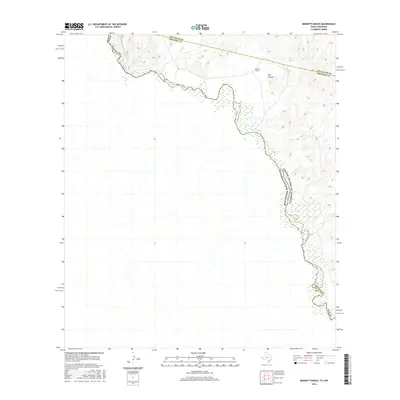
2016 Map of Bennett Ranch
USGS Topo · Published 2016About this map
The Rio Grande carves a winding path along the international border in this high-desert landscape where the Jeff Davis and Presidio County lines intersect. The terrain is defined by dry watercourses and isolated water sources that dictated the placement of early livestock operations. Evidence of this ranching history is found at the Bennett Ranch, situated near the mouth of Hog Canyon. These named canyons and intermittent drainages like Sand Cr provided the necessary topography for managing herds in an arid environment. Sparse but critical natural water points like Ash Spring mark the few reliable resources for travelers and residents navigating this remote frontier where the Chihuahuan Desert meets the river’s edge.
Find a feature on this map
9 named features on this map. Tap any name to fly to it.
Don’t see what you’re looking for? This feature index may not catch every label — zoom into the map to look around manually.
Map Details
Editions of this 2016 Bennett Ranch Map
This is the sole edition of this map. No revisions or reprints were ever made.
Other maps of this area

1892 · Chispa
USGS Topo · 1:125,000

1895 · Chispa
USGS Topo · 1:125,000

1896 · San Carlos
USGS Topo · 1:125,000

1897 · Eagle Mountain
USGS Topo · 1:125,000

1897 · Chispa
USGS Topo · 1:125,000

1916 · Eagle Mountain
USGS Topo · 1:125,000

1959 · Marfa
USGS Topo · 1:250,000

1965 · Marfa
USGS Topo · 1:250,000
1972 · Bramlett Ranch
USGS Topo · 1:24,000
1972 · Mesquite Spring
USGS Topo · 1:24,000