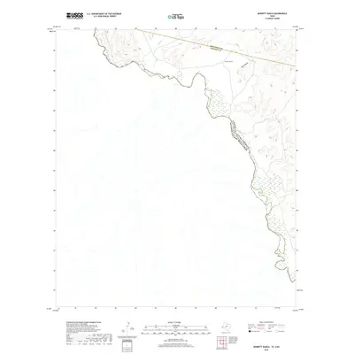
2019 Map of Bennett Ranch
USGS Topo · Published 2019About this map
Rio Grande defines the international boundary within this trans-border landscape, where the high desert of West Texas meets the United States of America and Mexico border. This sparsely settled region is anchored by Bennett Ranch, situated near the rugged geography of Hog Canyon. Natural water sources, critical to ranching and survival in this arid environment, are represented by Ash Spring and the drainage of Sand Cr. The map captures a moment of modern land use in a geography dominated by the sharp divide between the Jeff Davis and Presidio County lines and the winding river channel. The terrain is characterized by steep contour gradients leading down to the riverbank, illustrating the isolation and specific environmental challenges of the Big Bend borderlands.
Find a feature on this map
7 named features on this map. Tap any name to fly to it.
Don’t see what you’re looking for? This feature index may not catch every label — zoom into the map to look around manually.
Map Details
Editions of this 2019 Bennett Ranch Map
This is the sole edition of this map. No revisions or reprints were ever made.
Other maps of this area

1892 · Chispa
USGS Topo · 1:125,000

1895 · Chispa
USGS Topo · 1:125,000

1896 · San Carlos
USGS Topo · 1:125,000

1897 · Eagle Mountain
USGS Topo · 1:125,000

1897 · Chispa
USGS Topo · 1:125,000

1916 · Eagle Mountain
USGS Topo · 1:125,000

1959 · Marfa
USGS Topo · 1:250,000

1965 · Marfa
USGS Topo · 1:250,000
1972 · Bramlett Ranch
USGS Topo · 1:24,000
1972 · Mesquite Spring
USGS Topo · 1:24,000