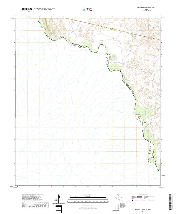
2022 Map of Bennett Ranch
USGS Topo · Published 2022About this map
The Rio Grande serves as the dominant geographical feature on this map, tracing the international boundary between the United States and Mexico in a remote stretch of West Texas. The landscape is defined by the sharp transition from the river's winding path to the dry uplands of the Big Bend region, where ephemeral drainage patterns like Sand Cr carve through the arid terrain. Further inland, the boundary between Jeff Davis and Presidio Counties bisects the northern reaches of the quadrangle. In the higher elevations to the east, localized water sources such as Ash Spring and the rugged topography of Hog Canyon highlight the scarce but critical natural landmarks of this desert environment. This survey captures a terrain where historical ranching and modern boundary monitoring intersect along a sparsely populated frontier.
Find a feature on this map
6 named features on this map. Tap any name to fly to it.
Don’t see what you’re looking for? This feature index may not catch every label — zoom into the map to look around manually.
Map Details
Editions of this 2022 Bennett Ranch Map
This is the sole edition of this map. No revisions or reprints were ever made.
Other maps of this area

1892 · Chispa
USGS Topo · 1:125,000

1895 · Chispa
USGS Topo · 1:125,000

1896 · San Carlos
USGS Topo · 1:125,000

1897 · Eagle Mountain
USGS Topo · 1:125,000

1897 · Chispa
USGS Topo · 1:125,000

1916 · Eagle Mountain
USGS Topo · 1:125,000

1959 · Marfa
USGS Topo · 1:250,000

1965 · Marfa
USGS Topo · 1:250,000
1972 · Bramlett Ranch
USGS Topo · 1:24,000
1972 · Mesquite Spring
USGS Topo · 1:24,000