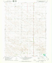
1979 Map of Bennett Reservoir West
USGS Topo · Published 1979About this map
Lodgepole Creek flows through this High Plains landscape, a vital water source in the western Nebraska panhandle during the late 1970s. The presence of the Bennett Reservoir in the southeast corner anchor the local drainage system, while the surrounding terrain is marked by an extensive network of extractive industry. Numerous Oil Wells and a Pump are scattered across the township lines, indicating the energy development that shaped the economy of Kimball County in this era. Communication and infrastructure are further evidenced by several Radio Towers and the Radio Tower (KIMB) located near the southern boundary. The map also documents multiple Gravel Pits, showing how local materials were harvested for regional road and construction needs amidst the open prairie and ranchland.
Find a feature on this map
11 named features on this map. Tap any name to fly to it.
Don’t see what you’re looking for? This feature index may not catch every label — zoom into the map to look around manually.
Map Details
Editions of this 1979 Bennett Reservoir West Map
This is the sole edition of this map. No revisions or reprints were ever made.
Other maps of this area

1954 · Scottsbluff
USGS Topo · 1:250,000

1958 · Scottsbluff
USGS Topo · 1:250,000

1972 · Owasco
USGS Topo · 1:24,000

1972 · Kimball
USGS Topo · 1:24,000

1972 · Oliver Reservoir
USGS Topo · 1:24,000

1973 · Kimball 2 NE
USGS Topo · 1:24,000

1973 · Kimball 2 SE
USGS Topo · 1:24,000

1973 · Kimball 1 SE
USGS Topo · 1:24,000

1973 · Kimball 1 NE
USGS Topo · 1:24,000

1973 · Kimball 1 NW
USGS Topo · 1:24,000