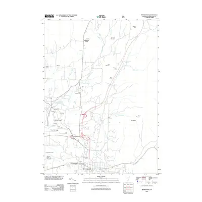
2012 Map of Bennington
USGS Topo · Published 2012About this map
The Walloomsac River valley serves as the industrial and historical heart of this Vermont landscape, where the Holden-Leonard Mill Complex and Paper Mill Village mark the long-standing manufacturing heritage of Bennington. The map provides a detailed view of the area's transition from its early settlement roots to its modern educational and aviation roles, featuring the campus of Bennington College and the William H Morse State Airport. Local history is deeply etched into the land through a high concentration of burial grounds, ranging from the Bennington Center Old First Church Cem to smaller family plots like the Rice-A Winslow Farm Cem. Preserved transportation landmarks including the Paper Mill Village Bridge and Silk Road Covered Bridge illustrate the region's commitment to maintaining its architectural character amidst the growth of North Bennington and Old Bennington.
Find a feature on this map
46 named features on this map. Tap any name to fly to it.
Don’t see what you’re looking for? This feature index may not catch every label — zoom into the map to look around manually.
Map Details
Editions of this 2012 Bennington Map
This is the sole edition of this map. No revisions or reprints were ever made.
Other maps of this area

1894 · Equinox
USGS Topo · 1:62,500

1895 · Cambridge
USGS Topo · 1:62,500

1896 · Equinox
USGS Topo · 1:62,500

1897 · Hoosick
USGS Topo · 1:62,500

1898 · Cambridge
USGS Topo · 1:62,500

1898 · Bennington
USGS Topo · 1:62,500

1900 · Taconic
USGS Topo · 1:125,000

1900 · Equinox
USGS Topo · 1:62,500

1901 · Cambridge
USGS Topo · 1:62,500

1903 · Mettawee
USGS Topo · 1:125,000