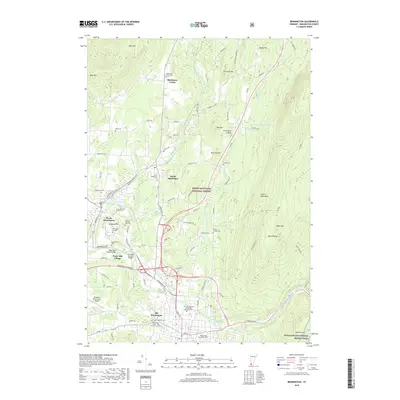
2018 Map of Bennington
USGS Topo · Published 2018About this map
Old Bennington and the surrounding valley floor serve as a historic hub where the Walloomsac River meets the Roaring Branch Walloomsac Brook. This landscape is defined by its deep architectural and educational roots, featuring the campus of Bennington College and several preserved landmarks of early Vermont infrastructure, including the Paper Mill Village Bridge and the Silk Road Covered Bridge. To the north, the terrain transitions into the protected slopes of the Green Mountain National Forest, while the valley settlements of North Bennington and South Shaftsbury are connected by a network of colonial-era routes like Paran Rd and Harwood Hill Rd. Genealogists will find significant value in the numerous burial grounds documented here, from the Bennington Center - Old First Church Cem to smaller family plots such as the Rice A Winslow Farm Cem.
Find a feature on this map
100 named features on this map. Tap any name to fly to it.
Don’t see what you’re looking for? This feature index may not catch every label — zoom into the map to look around manually.
Map Details
Editions of this 2018 Bennington Map
This is the sole edition of this map. No revisions or reprints were ever made.
Other maps of this area

1894 · Equinox
USGS Topo · 1:62,500

1895 · Cambridge
USGS Topo · 1:62,500

1896 · Equinox
USGS Topo · 1:62,500

1897 · Hoosick
USGS Topo · 1:62,500

1898 · Cambridge
USGS Topo · 1:62,500

1898 · Bennington
USGS Topo · 1:62,500

1900 · Taconic
USGS Topo · 1:125,000

1900 · Equinox
USGS Topo · 1:62,500

1901 · Cambridge
USGS Topo · 1:62,500

1903 · Mettawee
USGS Topo · 1:125,000