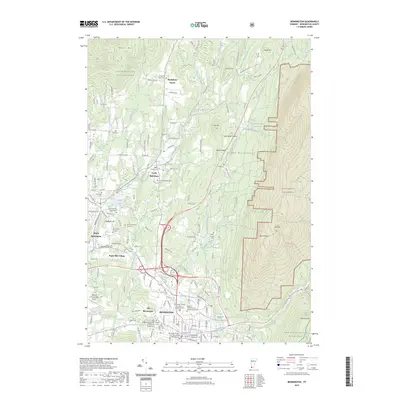
2023 Map of Bennington
USGS Topo · Published 2023About this map
Bennington and the historic district of Old Bennington anchor this landscape, where the modern corridor of the Vermont Railway meets the slopes of the Green Mountains. The map reveals a dense network of early settlements and family landmarks, from Paper Mill Village on the Walloomsac River to South Shaftsbury. Genealogists will find a significant concentration of burial grounds, including the Shaftsbury Center Cem and the Rice-A Winslow Farm Cem, documenting the area's agricultural and civic heritage. Higher elevations to the east, such as Hale Mtn and Bald Mtn, give way to the protected Glastenbury Wilderness, illustrating the sharp transition between the developed valley floor and the forested uplands. Institutional landmarks like Bennington College and the Vermont Veterans Home further define the town's contemporary character within its deep historical framework.
Find a feature on this map
153 named features on this map. Tap any name to fly to it.
Don’t see what you’re looking for? This feature index may not catch every label — zoom into the map to look around manually.
Map Details
Editions of this 2023 Bennington Map
This is the sole edition of this map. No revisions or reprints were ever made.
Other maps of this area

1894 · Equinox
USGS Topo · 1:62,500

1895 · Cambridge
USGS Topo · 1:62,500

1896 · Equinox
USGS Topo · 1:62,500

1897 · Hoosick
USGS Topo · 1:62,500

1898 · Cambridge
USGS Topo · 1:62,500

1898 · Bennington
USGS Topo · 1:62,500

1900 · Taconic
USGS Topo · 1:125,000

1900 · Equinox
USGS Topo · 1:62,500

1901 · Cambridge
USGS Topo · 1:62,500

1903 · Mettawee
USGS Topo · 1:125,000