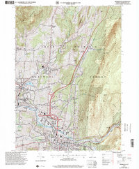
1997 Map of Bennington
USGS Topo · Published 2000About this map
Bennington anchors this Southwestern Vermont landscape, characterized by the sharp transition from the valley floor to the high elevations of the Green Mountain National Forest. The map documents a cluster of distinct historic cores, including Old Bennington with its prominent Battle Monument and the industrial heritage of Paper Mill Village along the Walloomsac River. The influence of the Vermont Railway is evident as it winds through North Bennington, passing near Lake Paran and Bennington College.
Find a feature on this map
51 named features on this map. Tap any name to fly to it.
Don’t see what you’re looking for? This feature index may not catch every label — zoom into the map to look around manually.
Map Details
Editions of this 1997 Bennington Map
This is the sole edition of this map. No revisions or reprints were ever made.
Other maps of this area

1894 · Equinox
USGS Topo · 1:62,500

1895 · Cambridge
USGS Topo · 1:62,500

1896 · Equinox
USGS Topo · 1:62,500

1897 · Hoosick
USGS Topo · 1:62,500

1898 · Cambridge
USGS Topo · 1:62,500

1898 · Bennington
USGS Topo · 1:62,500

1900 · Taconic
USGS Topo · 1:125,000

1900 · Equinox
USGS Topo · 1:62,500

1901 · Cambridge
USGS Topo · 1:62,500

1903 · Mettawee
USGS Topo · 1:125,000