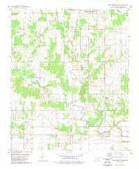
1980 Map of Bennington South
USGS Topo · Published 1981About this map
Bennington and the surrounding agricultural lands of southern Bryan County are defined by the meandering course of the Blue River. This landscape of the early 1980s reveals a network of rural communities including Bokchito, Midland, and Albany, each connected by a series of creeks such as Sassafras Creek, Sulphur Creek, and Tuklo Creek. The map is particularly valuable for genealogical research, identifying numerous local landmarks like Sulphur Springs Ch, Antioch Ch, and the Chisholtok Ch. Small cemeteries such as Labors Cem and McGee Springs Cem are scattered across the terrain, reflecting the long-standing family ties to this corner of Oklahoma. To the south, the settlement of Wade sits near the Rice Creek drainage, while industrial activity is noted at the Sandpit near Cherokee Lake.
Find a feature on this map
32 named features on this map. Tap any name to fly to it.
Don’t see what you’re looking for? This feature index may not catch every label — zoom into the map to look around manually.
Map Details
Editions of this 1980 Bennington South Map
This is the sole edition of this map. No revisions or reprints were ever made.
Other maps of this area

1899 · Atoka
USGS Topo · 1:125,000

1900 · Atoka
USGS Topo · 1:125,000

1901 · Antlers
USGS Topo · 1:125,000

1903 · Paris
USGS Topo · 1:125,000

1912 · Antlers
USGS Topo · 1:125,000

1925 · Antlers
USGS Topo · 1:125,000

1948 · Direct
USGS Topo · 1:62,500

1949 · Direct
USGS Topo · 1:62,500

1950 · Mcalester
USGS Topo · 1:250,000

1953 · Texarkana
USGS Topo · 1:250,000