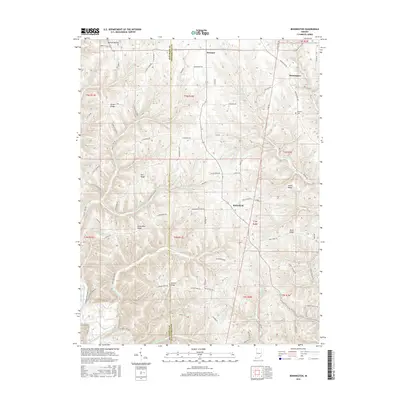
2016 Map of Bennington
USGS Topo · Published 2016About this map
Pleasant and Bennington serve as the primary hubs in this part of Switzerland County, where the landscape is defined by a series of prominent finger-like ridges. The terrain's character is shaped by deep hollows and narrow valleys like Horton Hollow, through which the Seals Fork and Brushy Fork drain. A complex network of local roads, many following the crests of these elevations, connects isolated rural homesteads and agricultural plots.
Find a feature on this map
90 named features on this map. Tap any name to fly to it.
Don’t see what you’re looking for? This feature index may not catch every label — zoom into the map to look around manually.
Map Details
Editions of this 2016 Bennington Map
This is the sole edition of this map. No revisions or reprints were ever made.
Other maps of this area

1943 · Vevay North
USGS Topo · 1:24,000

1943 · Brooksburg
USGS Topo · 1:24,000

1943 · Vevay South
USGS Topo · 1:24,000

1952 · Vevay South
USGS Topo · 1:24,000

1953 · Carrollton
USGS Topo · 1:24,000

1953 · Madison East
USGS Topo · 1:24,000

1956 · Bennington
USGS Topo · 1:24,000

1956 · Canaan
USGS Topo · 1:24,000

1956 · Louisville
USGS Topo · 1:250,000
1957 · Vevay North
USGS Topo · 1:24,000