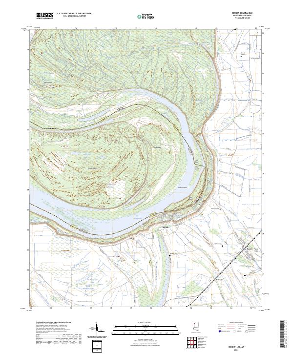
2024 Map of Benoit
USGS Topo · Published 2024About this map
Caulk Island and the meandering curves of the Mississippi River dominate this modern landscape, where the state boundary follows the historical course of the river through complex oxbows and islands. On the Mississippi side, the small settlement of Benoit sits near Egypt Ridge and Hannah, surrounded by a network of drainage features like Deer Creek and Straight Bayou that define the local agricultural layout. The map is particularly rich for genealogical research, identifying numerous family and community burial grounds such as Parthenia Cem, Speckter Cem, and Mount Olive Cem. The terrain is shaped by its proximity to the water, featuring large oxbow lakes like Lake Whittington and smaller water bodies including Big Monocnoc Lake and Bar Lake. Historical transportation patterns are preserved in names like Levee Rd and Rim Rd, which trace the high ground and protective structures built to manage the river's influence on the surrounding Bolivar County delta lands.
Find a feature on this map
69 named features on this map. Tap any name to fly to it.
Don’t see what you’re looking for? This feature index may not catch every label — zoom into the map to look around manually.
Map Details
Editions of this 2024 Benoit Map
This is the sole edition of this map. No revisions or reprints were ever made.
Other maps of this area

1933 · Lamont
USGS Topo · 1:62,500

1939 · Pace
USGS Topo · 1:62,500

1939 · Big Island
USGS Topo · 1:62,500

1939 · Lamont
USGS Topo · 1:62,500

1939 · Choctaw
USGS Topo · 1:62,500

1953 · Greenwood
USGS Topo · 1:250,000

1956 · Greenwood
USGS Topo · 1:250,000

1967 · Stringtown
USGS Topo · 1:24,000

1967 · Lobdell
USGS Topo · 1:24,000
1969 · Choctaw
USGS Topo · 1:62,500