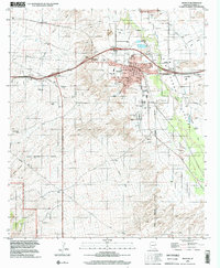
1996 Map of Benson
USGS Topo · Published 2002About this map
Benson serves as a significant desert hub in the San Pedro Valley, established at a critical junction of infrastructure. By the late 20th century, the town shows a clear evolution from its railroad roots, indicated by the Old Railroad Grade, into a modern community with its High Sch, Hospital, and several mobile home parks. The San Pedro River defines the eastern landscape, supporting local industry and agriculture near Pomerene and Cochise Gardens. To the southwest, the terrain rises into the Coronado National Forest, where the landscape transitions from the urban grid of Mark St and Pearl St to the isolated outposts of Post Ranch and various livestock infrastructure like the Cline Well and Sabin Wells. This survey documents a period of suburban transition as the Benson Corporate Boundary expanded against the backdrop of the rugged Arizona backcountry.
Find a feature on this map
34 named features on this map. Tap any name to fly to it.
Don’t see what you’re looking for? This feature index may not catch every label — zoom into the map to look around manually.
Map Details
Editions of this 1996 Benson Map
This is the sole edition of this map. No revisions or reprints were ever made.
Other maps of this area

1915 · Benson
USGS Topo · 1:125,000

1922 · St. David
USGS Topo · 1:62,500

1926 · Whetstone
USGS Topo · 1:62,500

1943 · Benson
USGS Topo · 1:125,000

1943 · Dragoon
USGS Topo · 1:62,500

1945 · Happy Valley
USGS Topo · 1:62,500

1956 · Nogales
USGS Topo · 1:250,000

1956 · Tucson
USGS Topo · 1:250,000

1958 · Nogales
USGS Topo · 1:250,000

1958 · Tucson
USGS Topo · 1:250,000