1926 Map of Whetstone
USGS Topo · Published 1926About this map
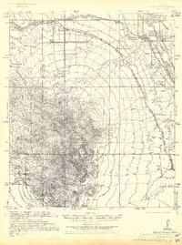
The San Pedro River valley serves as a critical corridor for both natural drainage and early 20th-century transportation in this 1926 survey. The town of Benson occupies a central role as a rail hub where the Southern Pacific and El Paso and Southwestern lines converge, following the river's path northward. This junction reflects the regional reliance on the railroad to connect isolated ranching and mining operations to broader markets. To the west, the landscape rises sharply into the Coronado National Forest, where high summits like Apache Peak and Granite Peak dominate the skyline. The presence of a Ranger Station and isolated family-named locations such as Wakefield Ranch and Trask Ranch highlights the dispersed nature of human settlement in the high desert. A curious industrial mark, the Old Oil Well, sits near the southeastern edge, indicating early exploration attempts in the valley floor.
Find a feature on this map
33 named features on this map. Tap any name to fly to it.
Don’t see what you’re looking for? This feature index may not catch every label — zoom into the map to look around manually.
Map Details
Editions of this 1926 Whetstone Map
This is the sole edition of this map. No revisions or reprints were ever made.
Historical Maps of Benson Through Time
1 maps found