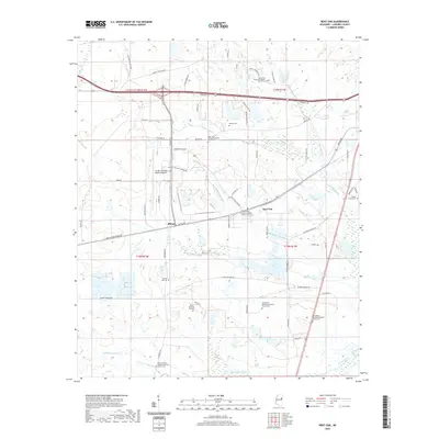
2020 Map of Bent Oak
USGS Topo · Published 2020About this map
Golden Triangle Regional Airport serves as a central hub for this portion of Lowndes County, which is characterized by a landscape of sprawling airfields and agricultural drainage patterns. The map documents several small community centers such as Billups and Bent Oak, which are interconnected by a network of rural roads and industrial spur lines. A dense concentration of missionary baptist churches and associated cemeteries, including Oak Grove Missionary Baptist Church Cem and Saint John Missionary Baptist Church Cem, suggests a long-standing social and genealogical fabric rooted in these specific congregations.
Find a feature on this map
70 named features on this map. Tap any name to fly to it.
Don’t see what you’re looking for? This feature index may not catch every label — zoom into the map to look around manually.
Map Details
Editions of this 2020 Bent Oak Map
This is the sole edition of this map. No revisions or reprints were ever made.
Other maps of this area

1953 · West Point
USGS Topo · 1:250,000

1958 · West Point
USGS Topo · 1:250,000

1959 · Artesia
USGS Topo · 1:62,500

1959 · West Point
USGS Topo · 1:62,500

1960 · Caledonia
USGS Topo · 1:62,500

1960 · Columbus
USGS Topo · 1:62,500

1963 · West Point
USGS Topo · 1:250,000

1982 · West Point
USGS Topo · 1:100,000

1984 · West Point
USGS Topo · 1:250,000
1987 · Columbus North
USGS Topo · 1:24,000