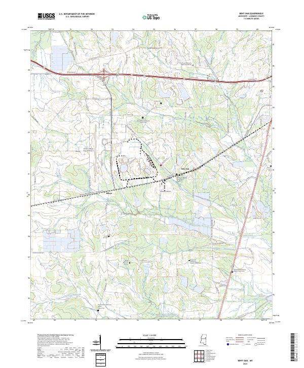
2024 Map of Bent Oak
USGS Topo · Published 2024About this map
Bent Oak and Billups serve as the primary settlement markers in this section of Lowndes County, where the landscape is defined by the extensive drainage systems of Gilmer Creek and Motley Slough. This modern survey reveals a community deeply rooted in its religious and familial history, evidenced by a high density of missionary baptist church cemeteries. Significant landmarks include the Golden Triangle Regional Airport and the Wicks Memorial Gardens, illustrating the modern infrastructure that overlays traditional rural life. The township is characterized by a dense network of local roads such as Artesia Rd and Gilmer Wilburn Rd, which navigate around the natural meandering of Magowah Creek and the North Branch Magowah Creek. The arrangement of these roads and the positioning of sites like Saint John Missionary Baptist Church Cem suggest a long-standing pattern of dispersed agricultural homesteads and local parish centers.
Find a feature on this map
74 named features on this map. Tap any name to fly to it.
Don’t see what you’re looking for? This feature index may not catch every label — zoom into the map to look around manually.
Map Details
Editions of this 2024 Bent Oak Map
This is the sole edition of this map. No revisions or reprints were ever made.
Other maps of this area

1953 · West Point
USGS Topo · 1:250,000

1958 · West Point
USGS Topo · 1:250,000

1959 · Artesia
USGS Topo · 1:62,500

1959 · West Point
USGS Topo · 1:62,500

1960 · Caledonia
USGS Topo · 1:62,500

1960 · Columbus
USGS Topo · 1:62,500

1963 · West Point
USGS Topo · 1:250,000

1982 · West Point
USGS Topo · 1:100,000

1984 · West Point
USGS Topo · 1:250,000
1987 · Columbus North
USGS Topo · 1:24,000