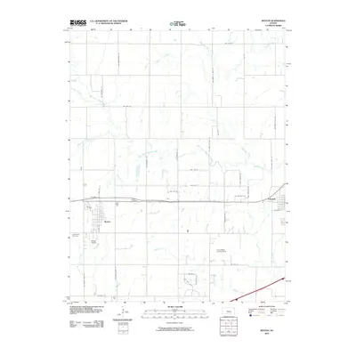
2010 Map of Benton
USGS Topo · Published 2010About this map
Benton and Towanda anchor this rural Butler County landscape, situated along a network of creek branches and river bends at the start of the 21st century. The map illustrates a transition from established town centers to the surrounding countryside, where Benton Cemetery and the Old Benton Cemetery offer significant points of interest for genealogists and local historians. The area's aviation heritage is visible through the Benton Airport and the private Greer Miller Landing Strip, indicating the role of general aviation in this prairie region.
Find a feature on this map
43 named features on this map. Tap any name to fly to it.
Don’t see what you’re looking for? This feature index may not catch every label — zoom into the map to look around manually.
Map Details
Editions of this 2010 Benton Map
This is the sole edition of this map. No revisions or reprints were ever made.
Other maps of this area

1888 · Eldorado
USGS Topo · 1:125,000

1889 · Wichita
USGS Topo · 1:125,000

1894 · Wichita
USGS Topo · 1:125,000

1945 · Andover
USGS Topo · 1:31,680

1955 · Santa Fe Lake
USGS Topo · 1:24,000

1955 · Benton
USGS Topo · 1:24,000

1955 · Greenwich
USGS Topo · 1:24,000

1955 · Wichita
USGS Topo · 1:250,000
1956 · Andover
USGS Topo · 1:24,000

1958 · Wichita
USGS Topo · 1:250,000