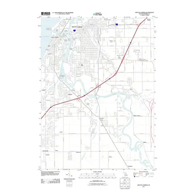
2011 Map of Benton Harbor
USGS Topo · Published 2011About this map
Saint Joseph and Benton Harbor stand at the confluence of the Saint Joseph River and the Paw Paw River in this 21st-century documentation of the Lake Michigan shoreline. The urban footprint is defined by its maritime and industrial infrastructure, including the Morrison Channel, West Basin Marina, and the City of Benton Harbor Waterworks. Beyond the commercial centers, the landscape transitions into established residential areas and institutional grounds such as Siena Heights University at Lake Michigan College and several expansive burial grounds including Morton Cemetery and Crystal Springs Cemetery.
Find a feature on this map
93 named features on this map. Tap any name to fly to it.
Don’t see what you’re looking for? This feature index may not catch every label — zoom into the map to look around manually.
Map Details
Editions of this 2011 Benton Harbor Map
This is the sole edition of this map. No revisions or reprints were ever made.
Other maps of this area

1927 · Niles
USGS Topo · 1:62,500

1927 · Benton Harbor
USGS Topo · 1:62,500

1930 · Three Oaks
USGS Topo · 1:62,500

1930 · Benton Harbor
USGS Topo · 1:62,500

1930 · Niles
USGS Topo · 1:62,500

1943 · Niles
USGS Topo · 1:62,500

1944 · Three Oaks
USGS Topo · 1:62,500

1953 · Chicago
USGS Topo · 1:250,000

1957 · Chicago
USGS Topo · 1:250,000

1958 · Racine
USGS Topo · 1:250,000