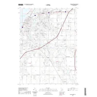
2019 Map of Benton Harbor
USGS Topo · Published 2019About this map
The Saint Joseph River and the Paw Paw River converge in this 2019 survey of the twin cities area, meeting just before they empty into Lake Michigan. The landscape is defined by the industrial and civic hubs of Benton Harbor and St. Joseph, featuring the Berrien County Courthouse and the expansive grounds of Lake Michigan College. The map captures a high degree of suburban and rural development moving south and east, where smaller communities like Fair Plain, Vineland, and Scottdale are established among a network of drains and creeks. Numerous cemeteries, such as Riverview Cem and B'nai Sholom Cem, are documented throughout the quadrangle, providing valuable reference points for local history. The presence of the CSX Transportation rail line and major routes like Territorial Rd highlight the region's role as a transportation corridor along the lake's eastern shore.
Find a feature on this map
147 named features on this map. Tap any name to fly to it.
Don’t see what you’re looking for? This feature index may not catch every label — zoom into the map to look around manually.
Map Details
Editions of this 2019 Benton Harbor Map
This is the sole edition of this map. No revisions or reprints were ever made.
Other maps of this area

1927 · Niles
USGS Topo · 1:62,500

1927 · Benton Harbor
USGS Topo · 1:62,500

1930 · Three Oaks
USGS Topo · 1:62,500

1930 · Benton Harbor
USGS Topo · 1:62,500

1930 · Niles
USGS Topo · 1:62,500

1943 · Niles
USGS Topo · 1:62,500

1944 · Three Oaks
USGS Topo · 1:62,500

1953 · Chicago
USGS Topo · 1:250,000

1957 · Chicago
USGS Topo · 1:250,000

1958 · Racine
USGS Topo · 1:250,000