
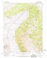
1962 Map of Benton
USGS Topo · Published 1964About this map
Benton serves as the primary settlement on this high-desert landscape during the early 1960s, situated at the base of the towering White Mountains. The map documents a transition from active ranching at Bramlette Ranch and Pedro Ranch to the industrial remains of an earlier era, notably the Old Railroad Grade that winds through Queen Valley. Significant vertical relief is captured across the boundary between the Inyo National Forest and Toiyabe National Forest, including the ascent to Boundary Peak and Montgomery Peak.
Find a feature on this map
83 named features on this map. Tap any name to fly to it.
Don’t see what you’re looking for? This feature index may not catch every label — zoom into the map to look around manually.
Map Details
Editions of this 1962 Benton Map
2 editions found
Other maps of this area

1909 · Hawthorne
USGS Topo · 1:250,000

1911 · Hawthorne
USGS Topo · 1:250,000

1914 · Mt. Morrison
USGS Topo · 1:125,000

1915 · Hawthorne
USGS Topo · 1:250,000

1917 · White Mountain
USGS Topo · 1:125,000

1947 · Mariposa
USGS Topo · 1:250,000

1948 · Walker Lake
USGS Topo · 1:250,000

1948 · Mariposa
USGS Topo · 1:250,000

1953 · Casa Diablo Mtn
USGS Topo · 1:62,500

1957 · Walker Lake
USGS Topo · 1:250,000