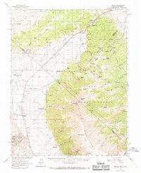
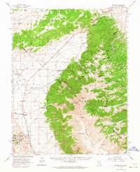
1962 Map of Benton
USGS Topo · Published 1969About this map
Benton sits at the foot of the White Mountains in this early 1960s survey, anchoring a region defined by high-altitude mining and ranching across the California-Nevada border. The map documents significant historical sites including Montgomery City and Queen Dicks, alongside active livestock operations at Bramlette Ranch and Hereford Valley Ranch. The landscape is a complex network of resource extraction and infrastructure, featuring the Old Railroad Grade and the Los Angeles Aqueduct cutting through the valleys.
Find a feature on this map
83 named features on this map. Tap any name to fly to it.
Don’t see what you’re looking for? This feature index may not catch every label — zoom into the map to look around manually.
Map Details
Editions of this 1962 Benton Map
2 editions found
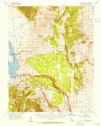
Other maps of this area

1909 · Hawthorne
USGS Topo · 1:250,000

1911 · Hawthorne
USGS Topo · 1:250,000

1914 · Mt. Morrison
USGS Topo · 1:125,000

1915 · Hawthorne
USGS Topo · 1:250,000

1917 · White Mountain
USGS Topo · 1:125,000

1947 · Mariposa
USGS Topo · 1:250,000

1948 · Walker Lake
USGS Topo · 1:250,000

1948 · Mariposa
USGS Topo · 1:250,000
1953 · Casa Diablo Mtn
USGS Topo · 1:62,500

1957 · Walker Lake
USGS Topo · 1:250,000