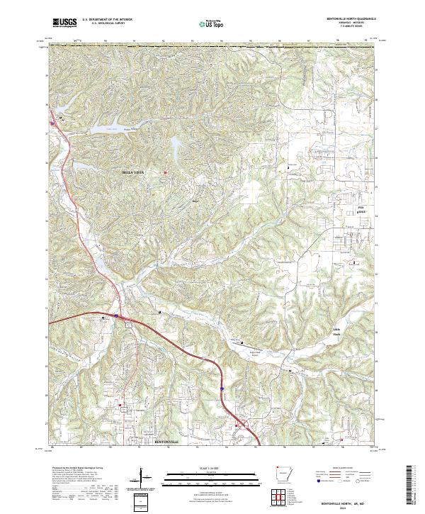
2024 Map of Bentonville North
USGS Topo · Published 2024About this map
Bentonville and its northern suburbs are defined by a complex drainage network where Little Sugar Creek and its many tributaries, including Spanker Creek and Brush Creek, carve deep hollows through the plateau. This 2024 survey captures the rapid modern development of Bella Vista and Little Flock, showing how residential expansion interacts with older topographical landmarks like Pea Ridge Hollow and Pumpkin Hollow.
Find a feature on this map
40 named features on this map. Tap any name to fly to it.
Don’t see what you’re looking for? This feature index may not catch every label — zoom into the map to look around manually.
Map Details
Editions of this 2024 Bentonville North Map
This is the sole edition of this map. No revisions or reprints were ever made.
Other maps of this area

1899 · Fayetteville
USGS Topo · 1:125,000

1901 · Fayetteville
USGS Topo · 1:125,000

1904 · Fayetteville
USGS Topo · 1:125,000

1940 · Noel
USGS Topo · 1:62,500

1941 · Rocky Comfort
USGS Topo · 1:62,500

1943 · Noel
USGS Topo · 1:62,500

1943 · Rocky Comfort
USGS Topo · 1:62,500

1954 · Tulsa
USGS Topo · 1:250,000

1958 · Rogers
USGS Topo · 1:24,000

1958 · Pea Ridge
USGS Topo · 1:24,000