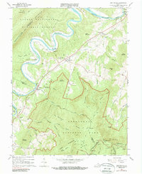
1966 Map of Bentonville
USGS Topo · Published 1987About this map
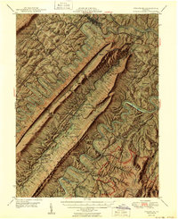
The South Fork Shenandoah River winds through the heart of this mid-1960s survey, marking a landscape defined by its high ridges and river crossings. Small communities like Bentonville and Limeton are situated along the Norfolk and Western rail line and the base of Allens Mountain, while the river's deep loops reveal historic points such as Burners Ford and the Indian Hollow Bridge. To the west, the Massanutten Mountain range rises within the George Washington National Forest, and to the east, the map captures the transition into Shenandoah National Park.
Find a feature on this map
65 named features on this map. Tap any name to fly to it.
Don’t see what you’re looking for? This feature index may not catch every label — zoom into the map to look around manually.
Map Details
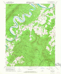
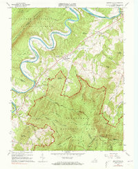
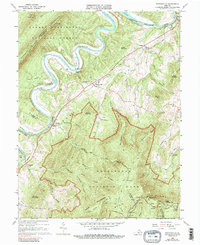
Editions of this 1966 Bentonville Map
4 editions found
Other maps of this area

1893 · Luray
USGS Topo · 1:125,000

1905 · Luray
USGS Topo · 1:125,000

1929 · Stony Man
USGS Topo · 1:48,000

1933 · Stony Man
USGS Topo · 1:62,500

1939 · Front Royal
USGS Topo · 1:48,000

1944 · Front Royal
USGS Topo · 1:62,500

1947 · Strasburg
USGS Topo · 1:62,500

1949 · Charlottesville
USGS Topo · 1:250,000
1950 · Strasburg
USGS Topo · 1:62,500

1956 · Charlottesville
USGS Topo · 1:250,000