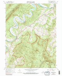
1966 Map of Bentonville
USGS Topo · Published 1987About this map
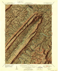
Bentonville and the winding South Fork Shenandoah River dominate this mid-century landscape where the Blue Ridge and Massanutten Mountain converge. The Norfolk and Western railroad tracks parallel the river, connecting small communities like Limeton, Overall, and Compton. Cultural landmarks are scattered throughout the valley, including St Pauls Ch and Mt Carmel Ch, alongside numerous family cemeteries that provide vital points for genealogical research. The map captures a transition from the river-level settlements to the high ridges of Shenandoah National Park, where the Skyline Drive and the Appalachian Trail follow the crest near Hogback Mtn. Features like Burners Ford and McCoys Ford indicate historic river crossing points used before modern bridge infrastructure became dominant.
Find a feature on this map
69 named features on this map. Tap any name to fly to it.
Don’t see what you’re looking for? This feature index may not catch every label — zoom into the map to look around manually.
Map Details
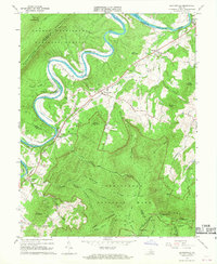
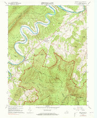
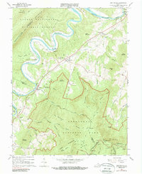
Editions of this 1966 Bentonville Map
4 editions found
Other maps of this area

1893 · Luray
USGS Topo · 1:125,000

1905 · Luray
USGS Topo · 1:125,000

1929 · Stony Man
USGS Topo · 1:48,000

1933 · Stony Man
USGS Topo · 1:62,500

1939 · Front Royal
USGS Topo · 1:48,000

1944 · Front Royal
USGS Topo · 1:62,500

1947 · Strasburg
USGS Topo · 1:62,500

1949 · Charlottesville
USGS Topo · 1:250,000
1950 · Strasburg
USGS Topo · 1:62,500

1956 · Charlottesville
USGS Topo · 1:250,000