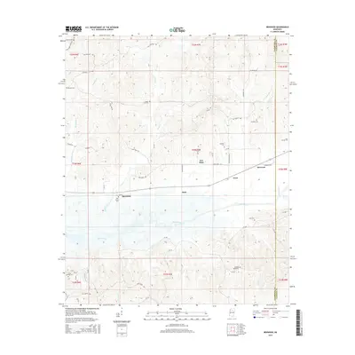
2015 Map of Benwood
USGS Topo · Published 2015About this map
Spearman and the surrounding hamlets of New Hope, Hyde, and Tyson anchor this rural landscape in north-central Mississippi. The terrain is defined by the broad floodplain of the Skuna River, where numerous small tributaries like York Cr, Spearman Cr, and Arimount Cr drain the rising timberland. This area, spanning the border of Yalobusha and Calhoun Counties, maintains a high density of rural burial grounds, which serve as primary markers of early settlement and family history. From Dividing Ridge Cem in the south to Harbor Cem in the north, these sites—including Elm Grove Cem, Hamblet Cem, and Arimount Cem—trace the genealogical roots of the local community. The road network, including Old Houston RD and Airmount RD, connects these scattered settlements and cemeteries across the river valley and its bordering ridges.
Find a feature on this map
50 named features on this map. Tap any name to fly to it.
Don’t see what you’re looking for? This feature index may not catch every label — zoom into the map to look around manually.
Map Details
Editions of this 2015 Benwood Map
This is the sole edition of this map. No revisions or reprints were ever made.
Other maps of this area

1953 · West Point
USGS Topo · 1:250,000

1954 · Pittsboro
USGS Topo · 1:62,500

1954 · Water Valley
USGS Topo · 1:62,500

1955 · Water Valley
USGS Topo · 1:62,500

1955 · Coffeeville
USGS Topo · 1:62,500

1956 · Tupelo
USGS Topo · 1:250,000

1958 · Tupelo
USGS Topo · 1:250,000

1958 · West Point
USGS Topo · 1:250,000

1963 · West Point
USGS Topo · 1:250,000
1971 · Coffeeville
USGS Topo · 1:24,000