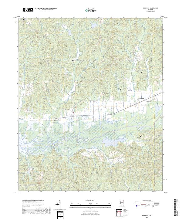
2024 Map of Benwood
USGS Topo · Published 2024About this map
The Skuna River bottomlands dominate the central portion of this survey, creating a broad, low-lying drainage basin that dictates the placement of rural settlements. Higher ground to the north and south supports the small communities of Spearman, Tyson, and Benwood, which are connected by a network of county roads such as the Old Houston Rd. The area is characterized by a significant number of family and community burial grounds, including Haven Hill Cem, New Hope Cem, and Elm Grove Cem, which serve as quiet markers of the region's long-standing residential history. The drainage pattern is further defined by several tributaries like York Creek, Glady Creek, and Spearman Creek, which feed into the main river channel. This geographic arrangement highlights the traditional reliance on elevated ridges for habitation while the fertile river valley was utilized for other purposes.
Find a feature on this map
58 named features on this map. Tap any name to fly to it.
Don’t see what you’re looking for? This feature index may not catch every label — zoom into the map to look around manually.
Map Details
Editions of this 2024 Benwood Map
This is the sole edition of this map. No revisions or reprints were ever made.
Other maps of this area

1953 · West Point
USGS Topo · 1:250,000

1954 · Pittsboro
USGS Topo · 1:62,500

1954 · Water Valley
USGS Topo · 1:62,500

1955 · Water Valley
USGS Topo · 1:62,500

1955 · Coffeeville
USGS Topo · 1:62,500

1956 · Tupelo
USGS Topo · 1:250,000

1958 · Tupelo
USGS Topo · 1:250,000

1958 · West Point
USGS Topo · 1:250,000

1963 · West Point
USGS Topo · 1:250,000
1971 · Coffeeville
USGS Topo · 1:24,000