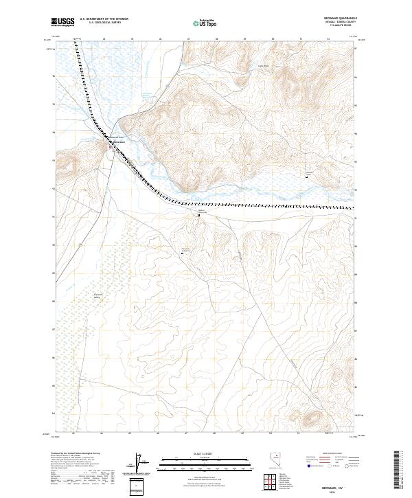
2021 Map of Beowawe
USGS Topo · Published 2021About this map
The high desert landscape of central Nevada is defined here by the transit corridor at Beowawe, where the Humboldt River and major rail lines cut through the terrain. This area has long served as a vital passage through the Great Basin, tracing the same path used by emigrants and early pioneers following the river valley westward. The map illustrates the specialized water management infrastructure of the region, showing the proximity of the settlement to the river's winding course and the natural geothermal and geological features that characterize this portion of the basin. Researchers can study the relationship between the waterway and the local rail infrastructure that continues to support the movement of goods through this sparsely populated section of Eureka County.
Find a feature on this map
2 named features on this map. Tap any name to fly to it.
Don’t see what you’re looking for? This feature index may not catch every label — zoom into the map to look around manually.
Map Details
Editions of this 2021 Beowawe Map
This is the sole edition of this map. No revisions or reprints were ever made.
Other maps of this area

1949 · Crescent Valley
USGS Topo · 1:62,500

1950 · Crescent Valley
USGS Topo · 1:62,500

1955 · Winnemucca
USGS Topo · 1:250,000

1957 · Frenchie Creek
USGS Topo · 1:62,500

1957 · Dunphy
USGS Topo · 1:62,500

1957 · Beowawe
USGS Topo · 1:62,500

1958 · Winnemucca
USGS Topo · 1:250,000

1962 · Winnemucca
USGS Topo · 1:250,000

1985 · Scotts Gulch
USGS Topo · 1:24,000
1985 · Crescent Valley
USGS Topo · 1:24,000