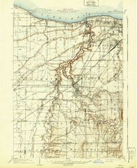
1904 Map of Berea
USGS Topo · Published 1939About this map
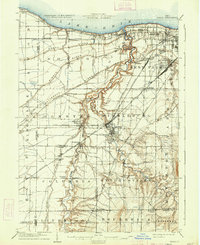
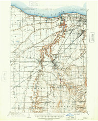
The confluence of the East Branch Rocky River and the West Branch Rocky River forms a dramatic central landscape in this early twentieth-century survey of western Cuyahoga and northern Lorain Counties. The village of Berea serves as a primary rail hub where the Lake Shore and Michigan Southern RR meets the Cleveland Cincinnati Chicago and St Louis Ry, reflecting the intense industrial development of the era. Northward, the shoreline of Lake Erie features early residential clusters at Clifton Park and Lakewood.
Find a feature on this map
79 named features on this map. Tap any name to fly to it.
Don’t see what you’re looking for? This feature index may not catch every label — zoom into the map to look around manually.
Map Details
Editions of this 1904 Berea Map
7 editions found
Other maps of this area

1901 · Oberlin
USGS Topo · 1:62,500

1901 · Euclid
USGS Topo · 1:62,500

1902 · Berea
USGS Topo · 1:62,500

1903 · Cleveland
USGS Topo · 1:62,500

1903 · Euclid
USGS Topo · 1:62,500

1903 · Oberlin
USGS Topo · 1:62,500

1903 · Akron
USGS Topo · 1:62,500

1904 · Berea
USGS Topo · 1:62,500

1904 · Medina
USGS Topo · 1:62,500

1904 · Wellington
USGS Topo · 1:62,500