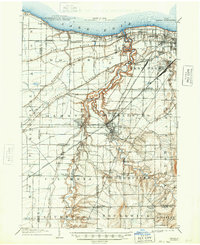
1904 Map of Berea
USGS Topo · Published 1948About this map
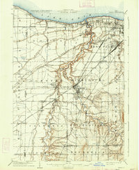
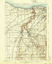
Lake Erie defines the northern boundary of this turn-of-the-century landscape, where the deeply incised valleys of the Rocky River and its tributaries break the flat coastal plains. The topography is dominated by a series of glacial features, most notably North Ridge, Middle Ridge, and Butternut Ridge, which served as natural corridors for early settlement and transport. In the hub of Berea, the confluence of the East Branch Rocky River and West Branch Rocky River creates a complex terrain of ravines and bluffs.
Find a feature on this map
77 named features on this map. Tap any name to fly to it.
Don’t see what you’re looking for? This feature index may not catch every label — zoom into the map to look around manually.
Map Details
Editions of this 1904 Berea Map
7 editions found
Other maps of this area

1901 · Oberlin
USGS Topo · 1:62,500

1901 · Euclid
USGS Topo · 1:62,500

1902 · Berea
USGS Topo · 1:62,500

1903 · Cleveland
USGS Topo · 1:62,500

1903 · Euclid
USGS Topo · 1:62,500

1903 · Oberlin
USGS Topo · 1:62,500

1903 · Akron
USGS Topo · 1:62,500

1904 · Berea
USGS Topo · 1:62,500

1904 · Medina
USGS Topo · 1:62,500

1904 · Wellington
USGS Topo · 1:62,500