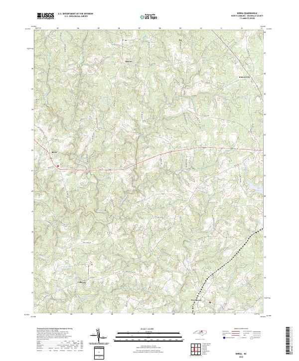
2022 Map of Berea
USGS Topo · Published 2022About this map
Berea and Hebron anchor the rolling landscape of Granville County, where the upper reaches of the Tar River and the N Fork Tar River wind through a patchwork of rural homesteads and agricultural tracts. This 2022 survey illustrates the enduring rural character of the region, defined by long-established communities like Culbreth and Providence. The map reveals a high density of family-named roads such as Bob Daniel Rd, Elam Currin Rd, and Joe Pruitt Rd, reflecting the deep-rooted genealogical heritage of this North Carolina tobacco country. Water features are central to the terrain, from larger impoundments like Lake Devin and Briggs Lake to the numerous small tributaries like Shelton Cr and Cattail Cr that feed into the Tar River basin. The geography remains largely agrarian, punctuated by forest cover and the crossroads of Kinton Fork.
Find a feature on this map
69 named features on this map. Tap any name to fly to it.
Don’t see what you’re looking for? This feature index may not catch every label — zoom into the map to look around manually.
Map Details
Editions of this 2022 Berea Map
This is the sole edition of this map. No revisions or reprints were ever made.
Other maps of this area

1943 · Roxboro
USGS Topo · 1:62,500

1943 · Creedmoor
USGS Topo · 1:62,500

1944 · Creedmoor
USGS Topo · 1:62,500

1951 · Durham North
USGS Topo · 1:62,500

1953 · Oxford
USGS Topo · 1:62,500

1953 · Greensboro
USGS Topo · 1:250,000

1954 · Greensboro
USGS Topo · 1:250,000

1962 · Greensboro
USGS Topo · 1:250,000

1966 · Greensboro
USGS Topo · 1:250,000

1966 · Oxford
USGS Topo · 1:62,500