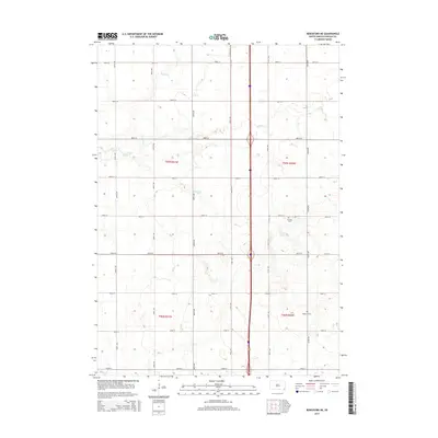
2015 Map of Beresford NE
USGS Topo · Published 2015About this map
Pioneer Cem and Nazareth Cem sit within the rural grid of Brooklyn Township, marking the resting places of early agricultural families in this portion of Lincoln County. The landscape is defined by the subtle drainage of Snake Creek, Saddle Creek, and Haram Creek, which meander across the prairie between a strictly surveyed network of range roads. This 2015 survey reflects the enduring section-line road system, where corridors like 470th Ave and 290th St partition the land into the original parcels of the Public Land Survey System. The absence of major settlements highlights the area's continued dedication to large-scale farming, preserved through generations within the boundaries of t97n r51w and neighboring townships.
Find a feature on this map
24 named features on this map. Tap any name to fly to it.
Don’t see what you’re looking for? This feature index may not catch every label — zoom into the map to look around manually.
Map Details
Editions of this 2015 Beresford NE Map
This is the sole edition of this map. No revisions or reprints were ever made.
Other maps of this area

1897 · Canton
USGS Topo · 1:125,000

1900 · Canton
USGS Topo · 1:125,000

1955 · Sioux Falls
USGS Topo · 1:250,000

1958 · Sioux Falls
USGS Topo · 1:250,000

1964 · Canton SW
USGS Topo · 1:24,000

1964 · Worthing
USGS Topo · 1:24,000

1964 · Lennox
USGS Topo · 1:24,000

1968 · Alcester NW
USGS Topo · 1:24,000
1968 · Alcester
USGS Topo · 1:24,000
1968 · Beresford NW
USGS Topo · 1:24,000
Featured Places
- Brooklyn Township, SD
- Lincoln Township, SD
- Delaware Township, SD
- Pleasant Township, SD
- Lincoln County, SD