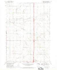
1968 Map of Beresford NE
USGS Topo · Published 1971About this map
The rolling plains of Lincoln and Brooklyn townships are defined by a network of drainage creeks and the modern imposition of a major north-south corridor. Surveyed in the late 1960s, this landscape shows the density of rural education and faith that once anchored these agricultural communities, with schoolhouses like Lincoln Center Sch and North Star Sch spaced systematically across the township grids.
Find a feature on this map
25 named features on this map. Tap any name to fly to it.
Don’t see what you’re looking for? This feature index may not catch every label — zoom into the map to look around manually.
Map Details
Editions of this 1968 Beresford NE Map
This is the sole edition of this map. No revisions or reprints were ever made.
Other maps of this area

1897 · Canton
USGS Topo · 1:125,000

1900 · Canton
USGS Topo · 1:125,000

1955 · Sioux Falls
USGS Topo · 1:250,000

1958 · Sioux Falls
USGS Topo · 1:250,000

1964 · Canton SW
USGS Topo · 1:24,000

1964 · Worthing
USGS Topo · 1:24,000

1964 · Lennox
USGS Topo · 1:24,000

1968 · Alcester NW
USGS Topo · 1:24,000
1968 · Alcester
USGS Topo · 1:24,000
1968 · Beresford NW
USGS Topo · 1:24,000
Featured Places
- Lincoln Township, SD
- Pleasant Township, SD
- Delaware Township, SD
- Brooklyn Township, SD
- Lincoln County, SD