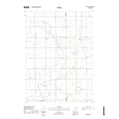
2017 Map of Beresford NW
USGS Topo · Published 2017About this map
The Vermillion River meanders through this agricultural landscape on the border of Turner and Lincoln counties. The town of Centerville anchors the southern portion of the map, situated near the confluence where Turkey Ridge Cr joins the larger river system. This region is defined by its grid-based rural infrastructure and numerous family and community burial sites, including the Melhus Cem, Frieling Cem, and Mount Zion Cem, which reflect the early settlement patterns of the area.
Find a feature on this map
35 named features on this map. Tap any name to fly to it.
Don’t see what you’re looking for? This feature index may not catch every label — zoom into the map to look around manually.
Map Details
Editions of this 2017 Beresford NW Map
This is the sole edition of this map. No revisions or reprints were ever made.
Other maps of this area

1897 · Canton
USGS Topo · 1:125,000

1898 · Parker
USGS Topo · 1:125,000

1900 · Canton
USGS Topo · 1:125,000

1955 · Sioux Falls
USGS Topo · 1:250,000

1958 · Sioux Falls
USGS Topo · 1:250,000

1964 · Worthing
USGS Topo · 1:24,000

1964 · Lennox
USGS Topo · 1:24,000
1968 · Beresford NW
USGS Topo · 1:24,000
1968 · Beresford
USGS Topo · 1:24,000
1968 · Hurley
USGS Topo · 1:24,000
Featured Places
- Centerville Township, SD
- Turner Township, SD
- Brooklyn Township, SD
- Delaware Township, SD
- Lincoln County, SD